
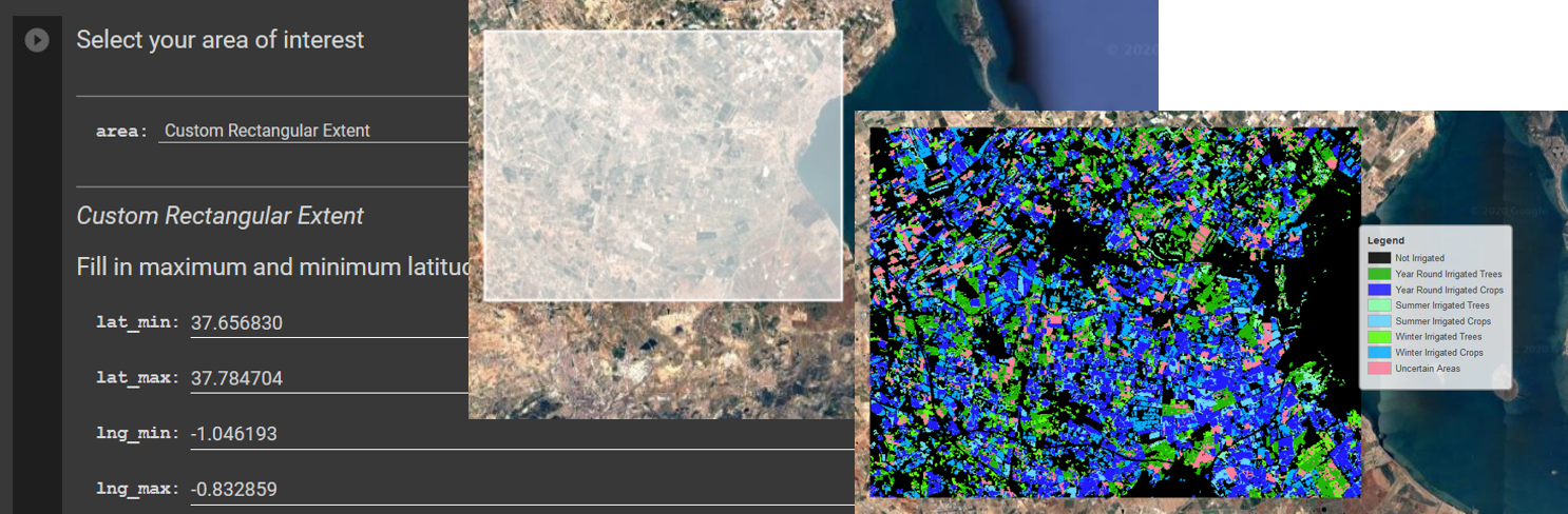
Back in June, a webinar, attended by 14 participants, was organized by the Soil and Water Conservation Research Group from CEBAS-CSIC to present the preliminary results of a study developing a methodology for unsupervised land cover classification using satellite imagery to distinguish irrigated agricultural areas in the Campo de Cartagena area (Murcia, Spain).
Expansion of (illegal) irrigated land in this area is particularly important since it is directly related to overexploitation of water resources and non-point source contamination of the Mar Menor lagoon by excessive nutrients and agrochemicals. In the classification methodology, a set of multi-variable thresholds is used to automatically generate training areas based on characteristic spectral signatures of different land cover classes for the summer and winter seasons. Then, supervised classification is performed using several indices derived from Landsat and Sentinel satellite imagery, after which the irrigated land areas from the seasonal land cover maps are combined to create a map of irrigated areas for a given year.
The method was calibrated using existing land cover maps for the years 1997, 2000 and 2009 in the Campo de Cartagena area. So far, validation of the methodology using two independent datasets for the years 2005 and 2017 resulted in accuracies of 74 and 71%. To test the methodology on a larger scale, classifications for the Murcia Province and the Segura Watershed were performed for the years 2005 and 2017. For these areas, the methodology proved to be less successful for the detection of irrigated areas but gave promising results for further research.
The study, conducted by Thedmer Postma and Javier Martínez-López, uses Google Earth Engine for satellite data gathering, classification and validation tasks. Besides, a user interface was developed to allow its use by non-experts.
The methodology developed can support the identification of irrigated agricultural areas over time in the MAL6 region, as part of the COASTAL project results, and serve as a reference value for the calibration of the System Dynamics model that is being developed.